
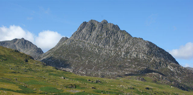
Most people look at Snowdon and see a mountain. A geologist sees something very different: ancient volcanoes, violent eruptions, continental collisions, deep oceans, vast glaciers, and millions upon millions of years of change. The landscape of Yr Wyddfa is not simply beautiful — it is one of the most important geological records in Britain. Every ridge, cliff, lake, and valley tells part of a story that began nearly half a billion years ago.
The Most Important Fact
Snowdon was once part of a volcano. Not a mountain — a volcano. The peak we see today is the heavily eroded remnant of an ancient volcanic landscape that existed approximately 450 million years ago. The rocks that form the mountain are mainly from the Ordovician Period — a time when dinosaurs had not evolved, mammals did not exist, flowering plants had not appeared, and Britain did not exist in its modern form. The world was completely different. Wales lay south of the equator. The Atlantic Ocean had not yet opened. The continents were arranged in entirely different configurations.
Wales Beneath the Sea
At the time Snowdon was forming, much of the region lay beneath a shallow ocean. Volcanic activity occurred within this marine environment, producing enormous quantities of lava, ash, and volcanic debris that settled on the seafloor and became incorporated into the sedimentary sequence. The compression of these marine sediments — combined with the heat and pressure of later geological events — transformed them into the rocks visible today. The summit mudstones are quite literally compressed ancient seabed. Walking on the summit of Yr Wyddfa, you walk on the floor of a vanished ocean.
The Snowdon Volcanic Group
Geologists identify a specific sequence of rock formations around Yr Wyddfa known as the Snowdon Volcanic Group. These include rhyolites (formed from high-silica lava), tuffs (compressed volcanic ash), and marine mudstones that indicate periods of relative volcanic calm between eruptions. The detailed sequence of these rocks has been studied by British geologists for over 150 years and continues to yield new information about the nature of volcanic systems in ancient Wales. Snowdon is, in this sense, an outdoor laboratory of continental importance.
Continental Collisions and Mountain Building
After the volcanic episode, a major phase of continental collision — the Caledonian Orogeny — caused the rocks of Wales to be folded, faulted, and metamorphosed under enormous pressure. This mountain-building episode occurred around 400 million years ago and is responsible for the general structural architecture of Snowdonia — the way the ridges and valleys are oriented, the patterns of weakness that determined where glaciers would later cut their cwms and U-shaped valleys. The mountains created by this episode were originally much higher than Snowdon today — Himalayan in scale. The subsequent 400 million years of erosion gradually reduced them to their current dimensions.
The Ice Ages
If volcanoes and continental collisions created Snowdon's raw material, glaciers shaped its distinctive character. During the Pleistocene Epoch — the last 2.6 million years — repeated ice ages drove glaciers over and through the mountain landscape. At the height of the most recent glaciation, around 20,000 years ago, an ice sheet kilometres thick covered the entire region. Individual glacier tongues carved the topography that visitors see and walk through today.
The process of glacial erosion created the most recognisable features of Snowdon. Cwms — the great rock basins that hold Glaslyn and Llyn Llydaw — formed where cirque glaciers accumulated and ground away at the back wall. Arêtes — sharp ridges like Crib Goch — formed where adjacent cirque glaciers eroded from both sides simultaneously, leaving a narrow fin of harder rock standing between them. U-shaped valleys — like the Llanberis Pass and Nantgwynant — formed as valley glaciers moved through and deepened pre-existing river valleys into their characteristic steep-sided profiles. Roches moutonnées — whale-shaped rock outcrops with a smooth upstream face and rougher downstream face — can be found at various points on the lower mountain slopes.
The Lakes
Glaslyn and Llyn Llydaw were both created by glacial action. Glaslyn occupies the floor of Cwm Glaslyn, held in place by a moraine dam — a ridge of glacial debris left when the glacier retreated. Its extraordinary copper-green colour comes from dissolved minerals in the bedrock: copper compounds released by weathering of the volcanic rocks give the water its distinctive tint, visible from considerable distances on a clear day. Llyn Llydaw below it was similarly carved, with the causeway across its lower end built to serve the copper mines that operated here in the nineteenth century.
Rock Types on the Mountain
Walking the different routes on Yr Wyddfa, you pass through recognisably different rock types. The lower Llanberis Path crosses pale grey Cambrian slates — the same rock that built the Victorian slate industry of north Wales. Higher up, the path crosses into the darker, more rugged volcanic rocks of the Snowdon Volcanic Group. On the summit plateau, the mudstones are dark grey-green and finely layered. The Crib Goch ridge itself is composed of particularly hard rhyolite — resistant to erosion, which is why it stands as a prominent ridge while the softer rocks around it have been eroded away.
Mining Heritage
The copper mineralisation associated with Snowdon's volcanic rocks attracted mining activity from at least the Bronze Age onwards. The most significant modern operation was the Britannia Copper Mine, which worked the slopes above Glaslyn from the mid-eighteenth century until the early twentieth. The ruins of the mine buildings can be seen from the Miners' Track — they give the path its name. Lead, zinc, and manganese were also worked at various points on the mountain. The mining heritage adds an industrial layer to the geological story, a reminder that these mountain rocks have been economically significant as well as scientifically fascinating.
Geological Features Worth Seeing
The Summit rocks — The mudstones and rhyolites at the top of Yr Wyddfa are visually remarkable on close inspection: finely laminated, sometimes folded, and full of tiny mineral crystals. Glaslyn — The copper-green colour is a direct expression of the geochemistry of the underlying rock. Crib Goch — The knife-edge is a textbook arête, impossible to misidentify. The Llanberis Pass — A classic glacially over-deepened valley, with vertical cwm walls rising hundreds of metres on both sides. Cwm Idwal — Across the valley in the Ogwen area, this is one of Britain's most important geological sites — where Charles Darwin studied glacial landforms in the 1840s and recognised the evidence for past glaciation.
Independently written — Snowdon.com